I will do analysis and solve spatial problems using google earth engine

Pakistan

I speak English, Urdu

3 orders completed

GIS Expert and Spatial Planner

I am GIS and Remote Sensing Analyst also Town Planning with more than 6 years Practical Experience in the GIS & RS Applications. I have full confidence regarding any type of analysis/ project relate t...
About this Gig

I am GIS & Remote Sensing specialist with hands-on expertise in Google Earth Engine (GEE), helping clients extract valuable insights from satellite imagery and spatial data.

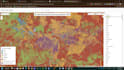
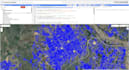
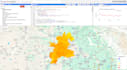
With over 6 years of experience, I can assist in analyzing environmental changes, vegetation indices, land use, flood mapping, and more using GEE and its vast satellite data catalog.

Services I Offer:

  • NDVI, EVI, SAVI,NDSI, NDWI, NDBI, Sultan's Formula and Vegetation Index Calculations
  • Land Use / Land Cover Classification
  • Change Detection (Multi-year analysis)
  • Time-Series Analysis
  • Urban Expansion and Built-up Area Mapping
  • Flood, Drought & Water Detection
  • Cloud Masking, Image Preprocessing
  • Exporting Maps & Data (TIFF, CSV, SHP, JSON, etc.)
  • Visualizing Data in Maps and Charts
  • GEE Code Optimization and Custom Scripts

Satellites I Work With:

Sentinel-1, Sentinel-2, Landsat 5/7/8/9, MODIS, CHIRPS, VIIRS, and more.

Deliverables May Include:

  • Interactive Map Links
  • High-resolution PNG / PDF Maps
  • Exported GeoTIFF / CSV files
  • GEE Code Script (.js)
  • Report/Documentation (on request)

Lets discuss your project before ordering to ensure I deliver exactly what you need.