Browse categories
Explore
Fiverr Pro
English
$
USD


hello
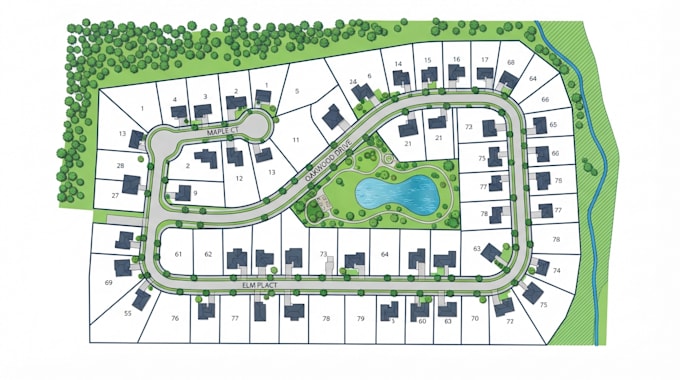
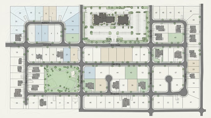
I will professionally redraw and vectorize your subdivision maps, plat maps, parcel maps, and site plans into clean, accurate, and editable digital files.
Whether you have a scanned drawing, PDF, image, or old survey document, I will recreate it with clear linework, proper alignment, and a professional presentation suitable for real estate, planning, surveying, permit submission, or printing.
What I can redraw
Why choose me
What you will receive
Please send your scanned map, PDF, or image before ordering if the drawing is complex or unclear.
I am committed to delivering professional vector maps that are clean, accurate, and ready for presentation, printing, or further editing.
contact or message me before order
Please inform the freelancer of any preferences or concerns regarding the use of AI tools in the completion and/or delivery of your order.
Architectural Master Planner
Languages
Can you redraw maps from a scanned image or PDF?
Yes. I can redraw subdivision maps, plat maps, parcel maps, and site plans from scanned images, PDFs, photos, or old survey documents.
Will the final file be editable?
Yes. I can provide editable vector files such as AI, SVG, and DXF depending on the package you choose.
Do you add labels, dimensions, and property boundaries?
Yes. I can include labels, dimensions, lot numbers, parcel boundaries, and other details that are visible in the original drawing.
What do you need to start the project?
Please send the original map or drawing (PDF, JPG, PNG, or scan) and let me know your preferred output format and any specific changes or corrections you want.