I will do gis digitization, mapping, and spatial data analysis

Pakistan

I speak English

Civil Engineer

I am a professional Civil Engineer offering reliable services in AutoCAD, GIS, engineering analysis, quantity estimation, BOQ preparation, and technical documentation. I work with ArcGIS, QGIS, HEC-HM...
About this Gig

I provide professional GIS digitization, GIS mapping, and spatial data analysis services using ArcGIS and QGIS. I convert satellite imagery, Google Earth imagery, scanned maps, PDFs, and CAD drawings into accurate, organized, and analysis-ready GIS data.

My GIS services include:

  • GIS feature digitization using points, lines, and polygons
  • Satellite imagery and map digitization
  • Georeferencing and raster-to-vector conversion
  • CAD-to-GIS conversion
  • Shapefile and geodatabase creation
  • Buildings, roads, boundaries, water bodies, drainage, and utility mapping
  • Land use and land cover mapping
  • Spatial data editing, attribute data creation, and topology correction
  • GIS map visualization and spatial analysis
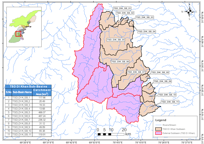
  • Watershed, subbasin, flood, and drainage mapping

I focus on data accuracy, clean geometry, proper coordinate systems, topology, and organized GIS datasets suitable for engineering, environmental, planning, and decision-making applications.

Whether you need a single map digitized or a complete GIS dataset prepared, I deliver accurate, reliable, and professional GIS results with attention to detail and timely communication.
My Portfolio