Browse categories
Explore
Fiverr Pro
English
$
USD


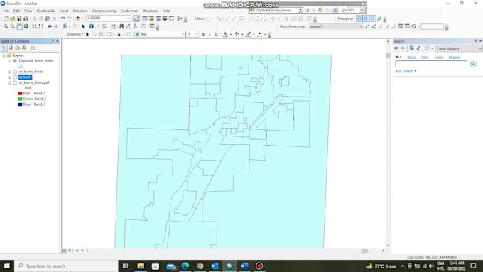
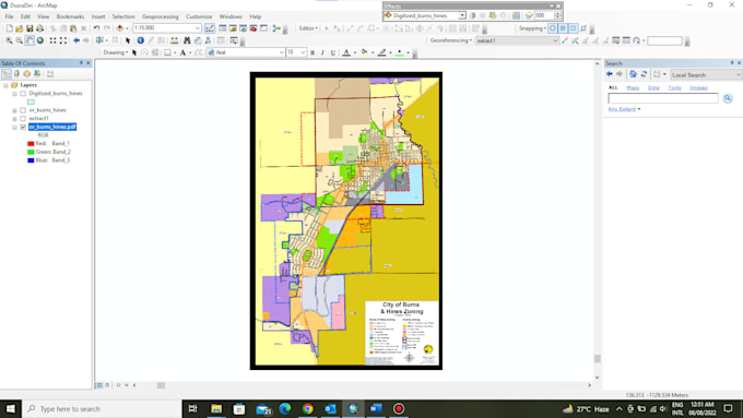
Having complete knowledge of gis and spatial science, I'll be preforming digitization via this gig. I'll be using ArcGIS and other required software if needed to geo-reference and digitize your scanned or drawn imagery. Shapefile along with raster will be provided to you as the result. The complete process of digitization is mentioned below:
Creating shapefile followed by masking then geo-referencing, digitization and data entry.
GIS, GeoAI, Web Mapping, Remote Sensing Expert
Languages
| (1) | ||
| (0) | ||
| (0) | ||
| (0) | ||
| (0) |

camkelm802

Canada
Needed help aligning and georeferencing two maps and hired Hayatullahabid for the job. He responded quickly and began working on it right away. He was extremely professional and has excellent communication skills. Completed the job perfectly and went above and beyond helping me.
| (1) | ||
| (0) | ||
| (0) | ||
| (0) | ||
| (0) |
camkelm802
Canada
Needed help aligning and georeferencing two maps and hired Hayatullahabid for the job. He responded quickly and began working on it right away. He was extremely professional and has excellent communication skills. Completed the job perfectly and went above and beyond helping me.