Browse categories
Explore
Fiverr Pro
English
$
USD

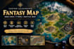
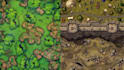
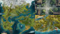
Need a custom fantasy map for your DnD campaign, RPG, or tabletop world? I create original fantasy maps to your setting, style, and gameplay needs.
WHAT I OFFER
WHY CHOOSE ME?
I focus on clear communication, thoughtful composition, and map details that support your story. I work from your ideas and references, confirm the scope before starting, and keep you updated. Each project is customized to your brief.
PERFECT FOR
Dungeon Masters, indie game developers, tabletop RPG creators, authors, worldbuilders, and board-game projects.
Please confirm grid layouts, VTT formatting, print dimensions, editable source files, and commercial-use needs before ordering. Complex maps or multiple locations may require a custom offer.
Send your map type, concept, preferred style, and references. I'll help you choose the right package before we begin. I deliver polished final artwork in your agreed file format and include package-based revisions.
fantasy map/dnd map/battle map/ rpg map/ttrpg map
Please inform the freelancer of any preferences or concerns regarding the use of AI tools in the completion and/or delivery of your order.
3D Terrain, Topographic Mapping, City Maps, Relief Models, 3D Visualization
Languages
What types of fantasy maps can you create?
I create fantasy world, regional, kingdom, city, town, dungeon, and battle maps for DnD, TTRPGs, RPGs, and fictional settings. Please share your concept so I can confirm the best package.
Can you follow my own map idea or reference?
Yes. You can provide sketches, written descriptions, reference images, or existing campaign notes. I will use them to understand your vision and confirm the scope before starting.
Will the map be suitable for printing or virtual tabletop games?
This depends on your requirements. Please specify the intended platform, dimensions, resolution, and whether you need a grid or gridless version before ordering.
What file formats will I receive?
Final delivery is provided in the formats stated in your selected package. Please request editable source files, layered artwork, or specialized exports before ordering so I can confirm availability.
Can you create a large map or multiple locations for my campaign?
Absolutely, provided the project is within my capabilities. Larger maps, complex battle layouts, and multiple locations may require a custom offer with an agreed scope, price, and delivery time.


