Browse categories
English
$
USD
Connect to your AI


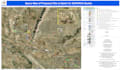
Professional GIS Mapping, Spatial Analysis & Georeferencing
Do you need GIS maps, georeferencing, or spatial analysis? I've got you covered! I specialize in creating accurate maps, processing spatial data, and providing in-depth geospatial analysis to help you make data-driven decisions.
My Services:
Why Choose Me?
How It Works:
Message me before ordering for custom requests. Let's bring your geospatial data to life!
GIS Mapping and Spatial Analysis Transforming Data into Insights
Languages
Is the data I share with you secure?
Yes! I guarantee 100% confidentiality. Your GIS data will be used only for your project and will not be shared with anyone.
What GIS software do you use?
I primarily use ArcGIS, QGIS, Google Earth, and spatial databases, depending on your project requirements.
What file formats will I receive?
You’ll receive high-resolution maps in PNG, JPEG, PDF, and GIS-compatible formats like SHP, GeoJSON, and KML. If you need specific formats, let me know!
Can you work with large datasets?
Yes! I can process and analyze large datasets. However, please message me first to discuss project scope and pricing for large-scale GIS work.
Do you provide spatial analysis and reports?
Absolutely! I offer detailed spatial analysis, geostatistical reports, and data-driven insights as part of my Standard and Premium packages.
Do you offer revisions?
Yes! I offer revisions based on your package to ensure you are 100% satisfied with the final output.
Do you offer consultation on GIS projects?
Yes! If you need guidance or GIS consultation, I can provide expert advice to help you make data-driven decisions.


