Browse categories
Explore
Fiverr Pro
English
$
USD

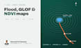
Need a clear, accurate map of flood risk, land change or vegetation for your project?
I am a climate GIS analyst from Gilgit-Baltistan, Pakistan, where glacier floods (GLOFs) happen every year. I turn free satellite data into maps your team, donors or examiners can trust.
WHAT I CAN MAP
WHAT YOU GET
TOOLS AND DATA
Google Earth Engine, QGIS, ArcGIS; Sentinel-1, Sentinel-2, Landsat, elevation data.
Please message me before ordering with your area of interest and dates, so I can confirm the data is available.
Environmentalist, Climate GIS, GHG Accounting and ESG Reporting
Languages
Which area can you map?
Anywhere with satellite coverage. Send me a place name, coordinates or a KML/shapefile of your area.
Is the satellite data free?
Yes. I use free public data (Sentinel and Landsat), so you do not pay extra for imagery. Commercial high-resolution imagery can be used if you supply or license it.
Can clouds stop a flood map?
Optical images can be blocked by cloud, so for floods I use Sentinel-1 radar, which sees through cloud.
Will I get the GIS files?
Yes, in the Standard and Premium packages: GeoTIFF, Shapefile or GeoPackage, ready for QGIS or ArcGIS.


