Browse categories
Explore
Fiverr Pro
English
$
USD


I am GIS Analyst and cartographer with more than 3 years of experience in the GIS field. I have deep skills in creating maps in Arcgis & Qgis.
Whether you are looking for GIS outsourcing, GIS services or need to hire a GIS mapping consultant, purchase consulting services to meet your needs.
Services
The following services will be provided here.
Spatial Data Extraction.
Spatial Data Transformation.
Spatial Data Visualization.
Spatial Data Analysis.
Georeferencing.
Network Analysis.
Site Selection.
Land use Landcover Development.
NDVI, NDWI, NDSI, calculation.
Hydrological Modeling with Arc SWAT
Supervise & Unsupervised Classification
Google Earth - Mapping.
Contour Mapping.
KML, KMX, GPX and Shapefile SHP creation and conversion.
Data analysis (Cleansing and further processing in excel.
Hydrology Extraction from DEM.
Digital Elevation Model processing.
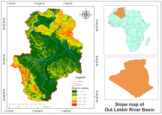
A slope map and watershed delineation using a Digital Elevation Model (DEM) of geospatial analysis, particularly in hydrology and terrain analysis.
Languages
