I will do image analysis for you or any kind of remote sensing task

Bangladesh

I speak Bengali, English, Hindi

3 orders completed

Expert in GIS, Remote Sensing, Research, and Design Solutions

Hi, I’m Mohammad Jahidul Islam Tushar, a GIS and Remote Sensing specialist with 5+ years of experience in crafting impactful maps and spatial analyses. I’ve worked with top organizations, turning comp...
About this Gig

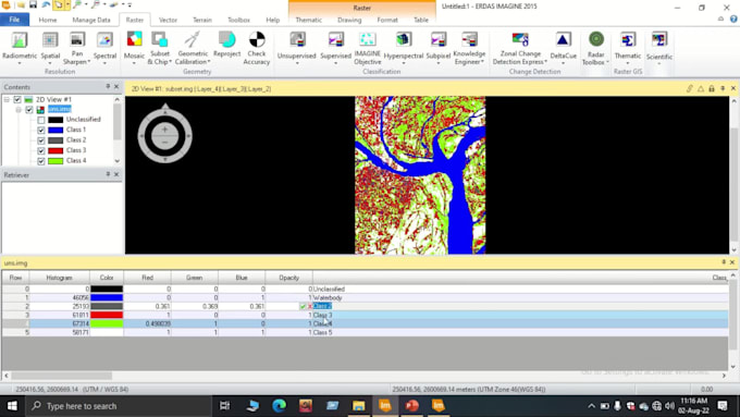
I have successfully completed over fifty satellite image classifications, during which I utilized either the supervised or unsupervised method, depending on the specific requirements of each image. I also have experience working with hybrid classifications. I am currently working on my Master of Science project using the Google Earth Engine platform and Random Forest Classification method. In this GIG I can utilize all those experiences to complete your project.

What kinds of services can I provide for you?

  • Geocoding service
  • Geoprocessing service ( Merge, Buffer, overlay, Intersect, Dissolve, Union, Erase)  
  • Image service (Download, Analysis)
  • Map service (Interactive, Simple)
  • Topographic Production (Map, layout, Digitize, Georeferencing)
  • Validation (Accuracy assessment)
  • Network Analysis
  • Date format Conversion (pdf to jpeg, raster to vector, kml to shap etc)
  • Documentation, SOP, Chart, Diagram
  • Advanced GIS Analysis ( Image Classification, NDVI, NDWI, Road Network Analysis, Watershed Delineation, Suitable Site Selection, Flood Hazard Mapping, Methodology Development, Model Builder etc...that based on the demand of your project and datasets)