Browse categories
Explore
Fiverr Pro
English
$
USD




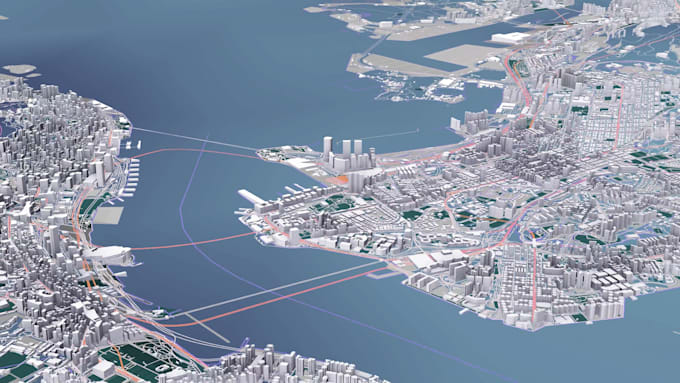
I create professional 3D map and GIS visualization animations for urban planning, transportation, real estate, environmental projects, and technology presentations. Using GIS data, 3D terrain, city environments, and motion graphics, I transform geographic information into cinematic visual stories. Ideal for map animations, location showcases, route visualization, smart city projects, and corporate presentations.
Choose to pay for your project per milestone by only paying when it’s time to start a new one or decide on a 1-time payment.
I'll create concept suggestions for your video.
I'll produce your explainer video.
Motion Graphics Artist and Video Editor
Languages
What types of map and GIS visualization projects do you create?
I create 3D map animations, GIS visualizations, terrain fly-throughs, location showcases, route animations, and city visualization videos for technology, infrastructure, transportation, and urban projects.
Do you provide GIS data processing and 3D terrain visualization?
Yes. I can prepare GIS data, terrain information, and spatial elements for visualization projects. Additional GIS processing and 3D environment creation can be discussed based on project requirements.
What materials should I provide before starting the project?
Please provide available materials such as location information, GIS data, maps, technical documents, logos, reference videos, or any existing visual assets.
Can you create a 3D city or terrain visualization from my location?
Yes. I can create customized 3D map environments, terrain visualization, and cinematic camera animations based on the project location and available data.
Do you provide complete GIS mapping or surveying services?
This service focuses on GIS visualization, animation, and visual storytelling. It does not replace professional surveying, GIS analysis, or engineering services.
Can you create different video formats for presentations or exhibitions?
Yes. I can prepare customized video outputs for corporate presentations, exhibitions, websites, social media, and other digital platforms.