Browse categories
Explore
Fiverr Pro
English
$
USD


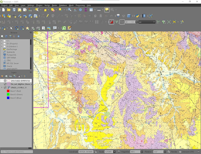
I will professionally digitize your maps into accurate polygons using QGIS, delivering high-quality GIS-ready datasets. While I have experience with geology maps, I also work with a variety of polygon-based maps to meet your project needs. Each map is carefully traced for precision and consistency, suitable for research, planning, environmental studies, or resource management.
Types of maps I digitize:
Output formats:
I provide accurate, clean, and reliable vector map digitization ready for analysis or presentation. Your maps will be delivered efficiently, with high attention to detail.
GIS Specialist
Languages
What types of maps can you digitize?
I can digitize a wide range of polygon-based maps, including geology, land use, cadastral/parcel maps, vegetation/forest maps, zoning, and more. If you have a specific map type, just send me a sample, and I’ll confirm compatibility.
What file formats will I receive?
Your digitized maps will be delivered in shapefile (.shp), GeoJSON (.geojson), or GeoPackage (.gpkg) format. All outputs are fully compatible with GIS software for analysis or presentation.
How long does it take to digitize a map?
Delivery depends on the number and complexity of maps. Typically: 1 map: 3 days ~5 maps: 7–10 days ~10 maps (Premium/Enterprise): 15–20 days This ensures accurate, high-quality digitization with time for revisions.