Browse categories
Explore
Fiverr Pro
English
$
USD


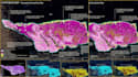

NEED TO IDENTIFY SUITABLE LOCATIONS USING GEOGRAPHIC DATA AND CLEAR SPARTIAL CRITERIA?
I provide GIS site suitability and site selection analysis using spatial analysis, GIS mapping, ArcGIS and QGIS workflows.
The analysis can combine factors such as land use/land cover, roads and accessibility, distance from services, terrain, slope, environmental constraints, population, risk areas and other project-specific spatial data.
Services can include:
Deliverables can include suitability maps, criterion maps, classified suitability zones, analytical outputs and supporting methodology notes.
The workflow can be adapted for urban planning, real estate, infrastructure, environmental projects, renewable energy, agriculture, facilities and other location-based decisions.
Transform scanned maps into usable GIS data
Languages
Q1. What is GIS site suitability analysis?
GIS site suitability analysis evaluates geographic locations against selected spatial criteria to identify areas that are more or less suitable for a particular project or activity.
Q2. What types of site selection projects can you analyse?
The workflow can be adapted for urban planning, real estate, infrastructure, renewable energy, agriculture, environmental projects, facilities, conservation and other location-based studies.
Q3. Can you use my own criteria?
Yes. You can provide your preferred criteria, weights, thresholds and suitability classes, and the analysis can be structured around your specified methodology.
Q4. Can you perform weighted overlay or MCDA?
Yes. Multi-criteria analysis can combine several spatial factors using methods such as weighted overlay or other agreed suitability-modelling approaches.
Q5. What GIS data can I provide?
You can provide Shapefile, GeoJSON, GeoTIFF, DEM, KML/KMZ, CSV, raster, vector or other relevant spatial datasets.
Q6. Can you source spatial or remote sensing data?
Open or publicly available datasets may be used when appropriate. The required data sources and availability should be confirmed before the analysis begins.
Q7. What will I receive after the analysis?
Depending on your package, you can receive professional suitability maps, criterion maps, analytical outputs, GIS source files and a methodology summary.


