Browse categories
Explore
Fiverr Pro
English
$
USD
Level 2
Has met high performance criteria and has a proven track record for meeting client expectations.
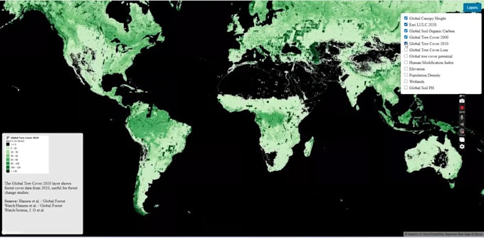
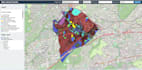
Professional web mapping and GIS development services using Mapbox, Leaflet, OpenLayers, and Google Maps API. Specialized in building interactive web maps, custom GIS web applications, and spatial data visualization for businesses, researchers, NGOs, startups, and developers.
Services include custom map design, multi-layer mapping, GeoJSON integration, administrative boundaries, filters and popups, map styling, performance optimization, and responsive web maps for desktop and mobile. Ideal for dashboards, analytics platforms, environmental mapping, real estate, logistics, health, and decision-support systems.
Clean code, scalable architecture, and deployment-ready solutions tailored to project requirements.


What types of web maps do you build?
I develop interactive web maps, GIS web applications, and spatial data visualization dashboards using Mapbox, Leaflet, OpenLayers, and Google Maps API. This includes business maps, analytics dashboards, environmental maps, real estate maps, logistics tracking, health and research maps.
What data formats can you work with?
I work with GeoJSON, CSV, Shapefiles, vector tiles, APIs, and databases. If your data needs cleaning, conversion, or optimization for web mapping performance, that is also supported.
Can you customize map design and styling?
Yes. I provide custom map styling, thematic mapping, legends, popups, filters, layer controls, and UI elements to match your brand or project requirements.
Will the web map work on mobile devices?
Absolutely. All maps are fully responsive, optimized for desktop, tablet, and mobile, with performance tuning for fast loading.
Do you provide deployment and support?
Yes. I deliver clean, well-documented, deployment-ready code and can assist with hosting, server setup, and deployment if needed.
What do you need from me to get started?
Project goals, data (or data source), preferred mapping library, reference examples (if any), and hosting details if deployment is required.
Can you handle complex GIS logic?
Yes. This includes spatial filtering, masking, admin boundaries, time-based visualization, live data integration, and performance optimization for large datasets.