Browse categories
Explore
Fiverr Pro
English
$
USD
Data Engineer, RAG AI Specialist and Spatial Data Expert
Stop wasting hours searching for coordinates!
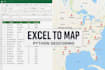
Have a spreadsheet full of addresses but no coordinates? I will solve this in record time. As a Spatial Data Engineer, I convert raw addresses into precise Latitude/Longitude coordinates (Geocoding) to put your data on a map.
What I need from you:
What you get:
FREE Bonus (Interactive Map):
I don't just give you raw numbers. I will run your data through my Python pipeline and include a custom Interactive Web Map (.html) plotting all locations for free! Open it in any browser to visualize your data instantly.
Why me?
Please message me before ordering if your data is highly unstructured!



Technology:
Excel
•
Google Sheets
•
Python
•
Zapier
•
Other
Is my address data safe and strictly confidential?
Absolutely. I process your data locally using secure Python scripts. Your files will not be shared with any third-party marketing services and will be completely deleted from my systems once the order is completed and approved.
Can you handle very large datasets (e.g., 50,000+ addresses)?
Yes! Since I use automated Python data pipelines (Pandas/Geopy) instead of manual entry, I can process massive Excel or CSV files efficiently. Please send me a message for a custom offer if your file exceeds the 10k addresses from the Premium package.
What happens if some addresses in my Excel file are misspelled or incomplete?
My geocoding API is quite robust and can handle minor typos. However, completely invalid or highly incomplete addresses might not return exact coordinates. I will cleanly flag any failed rows in the final Excel file, so you know exactly which ones need a manual review.
How does the free interactive web map work? Do I need special software?
No GIS software (like QGIS or ArcGIS) is required! I will generate a standalone HTML file using Python. You simply double-click the file, and it opens directly in your standard web browser, showing all your geocoded locations on an interactive, zoomable map.


