Browse categories
Explore
Fiverr Pro
English
$
USD

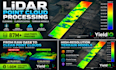


Need professional LiDAR point cloud processing for your GIS, mapping, construction, or environmental project?
At YieldIQ, I specialize in transforming raw LAS/LAZ LiDAR data into clean, organized, GIS-ready datasets using CloudCompare and QGIS.
Services include:
Choose Your Package:
Basic $75: Clean up to 5 million points, remove noise, and deliver LAS/LAZ files.
Standard $175: Merge, clean, and classify up to 25 million points.
Premium $350: Process up to 100 million points, including ground classification and a 1-meter DTM GeoTIFF.
I have independently processed datasets exceeding 87 million LiDAR points and prioritize organized deliverables, clear communication, and dependable service.
Please contact me before ordering to confirm dataset size, file compatibility, coordinate systems, and project requirements.
Custom quotes are available for larger datasets and specialized processing.
Owner LiDAR and GIS Data Processing Specialist
Languages
What LiDAR file formats do you accept?
I primarily work with LAS and LAZ point cloud files. Please contact me before ordering if your data is in another format.
What information do you need to begin?
Please provide your LAS/LAZ files, the coordinate reference system (if known), and a description of your desired outputs. Include any specific classification or filtering requirements.
Can you process large LiDAR datasets?
Yes. My Premium package covers up to 100 million input points. Larger datasets may be accepted through a custom offer after reviewing file size and processing requirements.
Can you create Digital Terrain Models (DTMs)?
Yes. I can generate georeferenced DTM GeoTIFFs from suitable ground-classified LiDAR data. A 1-meter DTM is included in Premium, subject to sufficient point density and coverage.
Do you offer ground and non-ground classification?
Yes. I use CloudCompare to separate ground and non-ground points. Results depend on terrain complexity, vegetation, and the quality of the source data.
Are your deliverables survey-grade or engineering-certified?
No. I provide LiDAR processing and GIS-ready data products, not licensed surveying or engineering certification. Clients should independently verify accuracy for regulated or safety-critical applications.


