I will design beautiful gis maps and accurate georeferencing fast

J
juanmanuelramos
J
juanmanuelramos
Juan R.

About this gig

High-Quality Geospatial Solutions for Your Projects

Are you looking for professional, accurate, and visually stunning maps? As an Environmental Engineer, I specialize in transforming complex geospatial data into clear, actionable insights using ArcGIS .


What I offer:

  • Advanced Spatial Analysis: Heat maps, proximity analysis, and terrain modeling.
  • Remote Sensing: Sentinel & Landsat processing, NDVI, and land-use change detection.
  • Cartographic Design: High-quality, publication-ready maps (PDF, PNG, Shapefiles).
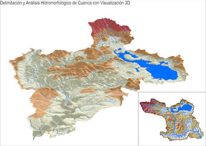
  • Hydrological Analysis: Watershed delineation and drainage patterns.

Why choose my services?

  • Engineering Background: Technical accuracy is my priority.
  • Customized Workflow: Every project is unique; I adapt to your specific needs.
  • Full Support: I provide the final maps AND the source GIS-ready layers.

Important: Project complexity varies. Please contact me before ordering so we can discuss your requirements and I can provide a custom quote that fits your budget and timeline.


Get to know Juan R.

Juan R.

Environmental Engineer GIS Specialist

5.0(5)
  • FromArgentina
  • Member sinceNov 2020
  • Avg. response time1 hour
  • Last delivery3 months
  • Languages

    Spanish, Portuguese, English
I am an Environmental Engineer specialized in GIS mapping, remote sensing, and spatial analysis. I work with satellite imagery and geospatial data to create clear, accurate, and professional maps for environmental, academic, and business projects. I have hands-on experience using ArcGIS Pro, processing Sentinel and Landsat imagery, and performing land-use analysis, vegetation indices, and change detection. My focus is on delivering reliable results with clean cartographic design and practical interpretation. I value clear communication, attention to detail, and on-time delivery.

My Portfolio