Browse categories
Explore
Fiverr Pro
English
$
USD


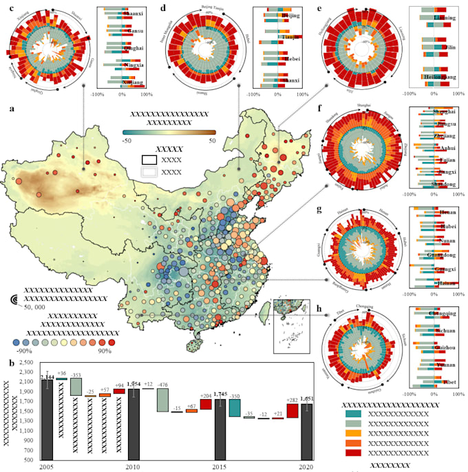
I will create professional GIS maps and geospatial visualizations from your spatial data. I specialize in clear and visually appealing cartographic design, helping transform complex geospatial datasets into informative and high-quality maps.
My services include single-dataset maps, multi-layer spatial visualization, and advanced map compositions that integrate multiple datasets, icons, and layout elements. These maps can be used for research papers, reports, presentations, and data storytelling.
I work with industry tools such as ArcGIS, QGIS, and Python to process and visualize spatial data accurately and efficiently. Whether you need a simple thematic map, a multi-layer analytical map, or a complex figure combining several spatial elements, I can help you create a clear and professional result.
Deliverables can include high-resolution map images suitable for publications and presentations, as well as GIS-ready files if required.
If you have specific data, styles, or requirements, feel free to contact me before placing an order so we can discuss the best solution for your project.
Complex Geospatial Visualization
Languages