Browse categories
Explore
Fiverr Pro
English
$
USD

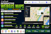
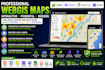
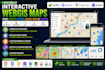
Need a professional interactive map for your website, dashboard, business, or research project? I build modern WebGIS solutions using Leaflet, Mapbox, Google Maps API, GeoJSON, JavaScript, HTML, and CSS to create fast, responsive, and user-friendly mapping applications.
Whether you need a location finder, real estate map, tourism map, logistics dashboard, environmental visualization, or a custom GIS web application, I can develop a solution tailored to your goals.
Services I Offer
Why Choose Me?
I can work with GeoJSON, Shapefile, KML, KMZ, CSV, Excel, and other GIS data formats to create interactive maps that perform smoothly across desktop and mobile devices.
Please contact me before placing your order.
Professional GIS Specialist and Geospatial Analyst
Languages
Can you build interactive maps with Leaflet?
Yes. I create responsive and feature-rich interactive maps using Leaflet.js.
Do you work with Mapbox?
Yes. I can build custom Mapbox maps with styling, layers, markers, and data visualization.
Can you integrate Google Maps into my website?
Yes. I can integrate Google Maps API with custom markers, polygons, routes, and location search.
Which GIS file formats do you support?
GeoJSON, Shapefile, KML, KMZ, CSV, Excel, GeoPackage, and other common GIS formats.
Will my map work on mobile devices?
Yes. All WebGIS projects are designed to be fully responsive across desktop, tablet, and mobile devices.
Can you connect maps to external data?
Yes. I can integrate APIs, databases, and dynamic datasets where appropriate for your project.
Can you customize the map design?
Absolutely. Colors, icons, layers, controls, branding, and user interface can all be customized.
Will I receive the source code?
Yes. Source code is included according to your selected package.


