Browse categories
Explore
Fiverr Pro
English
$
USD


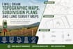
Welcome to my professional land surveying and mapping service!
I will provide accurate, detailed, and professional topographic maps, subdivision plans, and land survey maps tailored for land development, property documentation, engineering projects, and city permit applications.
With years of experience in land surveying and drafting, I deliver high-quality plans using industry-standard software to ensure precision, clarity, and compliance with local requirements.
My services include:
Why choose me?
Please contact me before placing an order to discuss your project details and ensure the best service package for your needs.
Please inform the freelancer of any preferences or concerns regarding the use of AI tools in the completion and/or delivery of your order.
Licensed Architect
Languages
