Browse categories
Explore
Fiverr Pro
English
$
USD


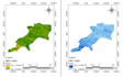
As a specialist in precision index computation and drone image processing, I raise projects to a higher level by paying close attention to every little detail. I make sure that all of your data is carefully analysed, concentrating on reducing drone-captured footage to the highest quality possible and computing important indices with unmatched accuracy.
My services are tailored to your individual requirements, regardless of whether you work in urban planning, agriculture, environmental analysis, or any other profession that uses geographical data. I process images very carefully, eliminating artefacts and boosting sharpness to bring out even the smallest details.
I don't stop there, though. I have the ability to compute critical indices that are necessary for making well-informed decisions. I offer accurate measures to support your agricultural planning, from NDVI vegetation analysis to moisture indices.
You can rely on me to give accurate and fast findings, making sure you get useful information when you need it most. Working together, i can fully utilise your drone data to help you make wise decisions that lead to success.
On a mission to making homeland easier to navigate
Languages
| (1) | ||
| (0) | ||
| (0) | ||
| (0) | ||
| (0) |
seedergy

United States
Great work done.
$50
Price
3 days
Duration
| (1) | ||
| (0) | ||
| (0) | ||
| (0) | ||
| (0) |
seedergy
United States
Great work done.
$50
Price
3 days
Duration


