Browse categories
Explore
Fiverr Pro
English
$
USD


Hello, I'm a Architect with years of experience in the fields of Scan-to-BIM, UAV, GIS, surveying, and mapping. My expertise focuses on accurate ground / non-ground classification, DEM, DTM, and contour line generation for surveying, engineering, and infrastructure projects.
In addition to data processing, I am an experienced UAV pilot, directly operating professional LiDAR and photogrammetry platforms such as DJI Matrice 300 RTK, Matrice 350 RTK with Zenmuse L1/L2, Matrice 3E/4E/3T, Phantom 4 RTK, Stormbee UAV S20 with FARO scanner, and senseFly eBee Plus.
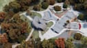
Here I will remodel digital surface elevation model, rvt stl terrain model for any location, let get work
Please inform the freelancer of any preferences or concerns regarding the use of AI tools in the completion and/or delivery of your order.
DTM DSM DEM Model
Languages
