Browse categories
Explore
Fiverr Pro
English
$
USD


"I will provide accurate GIS georeferencing and map digitization services"
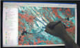
Are you looking to transform your old scanned maps, aerial photos, or historical documents into precise, usable digital data? As a dedicated and detail-oriented GIS freelancer using ArcGIS Pro and QGIS, I am committed to delivering high-quality, reliable results for your project needs.
I understand the importance of accuracy in spatial data. I will work diligently to align your non-spatial imagery to real-world coordinates and convert raster data into editable vector formats (points, lines, and polygons).
My Services Include:
Languages
What information do you need to start?
I require the source image/map file, the general location of the area (city/country), and ideally, any known coordinates or a reference map to ensure precise alignment.
What file formats do you deliver?
I typically deliver Shapefiles (.shp), KML/KMZ, GeoJSON, GeoTIFF, or georeferenced PDFs. Just let me know which you prefer!
