Browse categories
Explore
Fiverr Pro
English
$
USD

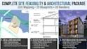


Buying land or building in the US and worried about hidden flood risks, zoning rules, or high insurance costs? Get complete clarity before you invest.
I analyze property boundaries, slope elevations, and FEMA flood zones across the United States. I help buyers, real estate investors, and developers determine whether a property falls in a flood plain, identify safe buildable zones, and prepare permit-ready site plans.
WHAT YOU GET
PERFECT FOR
HOW IT WORKS
IMPORTANT NOTE
WHY CHOOSE ME
BEFORE ORDERING
Message me with your property address for a quick preliminary review!
Fiverr does not screen freelancers in this category. Please verify qualifications and discuss requirements with the freelancer before ordering, including any preferences regarding the use of AI tools.
GIS Land Feasibility Maps, 2D CAD Plans and 3D Renders
Languages
What details do I need to provide to get started?
Simply send your property address, APN/Parcel ID, or GPS coordinates. If you have an existing survey, boundary sketch, or specific project requirements, please attach them as well!
What if I don’t have a survey or full measurements?
No problem! I can work from Google Maps, hand-drawn sketches, property appraiser maps, or other public data. Just send me what you have — I’ll guide you through the rest.
How fast can you deliver?
Standard delivery is within 2 days, and I offer 1-day express delivery if you're in a hurry. I also include 1–2 free revisions to ensure your satisfaction.
What’s included in the final delivery?
You will receive a high-quality PDF ready for submission. If your package includes source files, you’ll also get a SHP, DWG or similar CAD format upon delivery.
Can this site plan be used for permit applications?
Yes. My site plans are prepared to meet the requirements of most U.S. counties and municipalities. They include scale, setbacks, property lines, and key notes — suitable for permit submission. If your city has specific formatting rules, let me know in advance.
Will you revise the drawing if the city/township requests changes?
Yes! I include 2 rounds of revisions. If your city has specific requirements, just send me their comments and I will adjust the plan accordingly.


