Browse categories
Explore
Fiverr Pro
English
$
USD

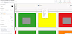
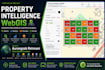


Need an interactive WebGIS dashboard to visualize, explore, and analyze your spatial data?
I will build a professional WebGIS dashboard or interactive web mapping application tailored to your project requirements.
I can transform your GIS data into an easy-to-use interactive mapping experience with maps, layers, filters, popups, statistics, charts, and spatial information.
What I can provide:
Interactive WebGIS maps and dashboards
GIS data visualization and spatial mapping
Layer controls, legends, popups, and filters
Search and location-based functionality
Interactive charts, KPIs, and statistics
GeoJSON, Shapefile, CSV, and other spatial data integration
ArcGIS/QGIS data preparation
Responsive web mapping interfaces
Custom functionality based on your requirements
Suitable for:
Real estate, agriculture, environmental monitoring, land management, infrastructure, utilities, business intelligence, research, and other location-based projects.
I focus on clean visualization, accurate spatial data, intuitive interfaces, and practical GIS solutions.
Please contact me before ordering for complex or custom WebGIS projects so we can define the scope, data requirements, and functionality.
GIS Developer, Google Earth Engine, Python Automation, ArcGIS Pro
Languages
What GIS data formats can I provide?
You can provide Shapefile, GeoJSON, KML/KMZ, CSV with coordinates, GeoPackage, raster data, or other common GIS formats. Contact me if you have a different format.
Can you build a custom interactive WebGIS dashboard?
Yes. I can build a WebGIS dashboard based on your data and requirements, including interactive maps, layers, popups, filters, search tools, charts, KPIs, legends, and other custom functionality.
Can you prepare or clean my GIS data before building the dashboard?
Yes. I can prepare, clean, convert, organize, and optimize spatial data using GIS tools before integrating it into the WebGIS dashboard. Complex data preparation may require a custom offer.
Will the WebGIS dashboard work on a website?
Yes. Depending on your package and requirements, the dashboard can be prepared for web use or embedding into an existing website. Please contact me first if you need hosting or custom website integration.
Do you provide source files or source code?
Yes. Source files/code can be provided according to the agreed project scope. Please mention this before ordering so I can include the required files and documentation in your delivery.


