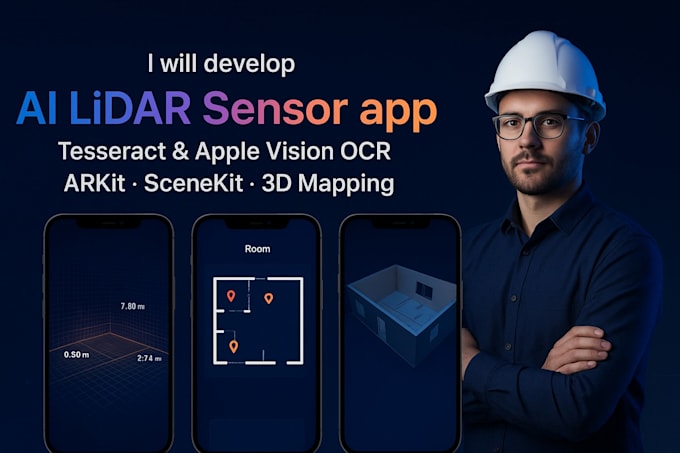
I develop AI-powered iOS apps that combine LiDAR scanning, OCR, ARKit, and 3D mapping for fast, accurate, and secure data capture.
Service I Offer:
- iOS LiDAR scanning app development
- 3D room/space mapping using LiDAR
- ARKit-based measurement tools
- OCR document/text extraction apps
- SceneKit 3D visualization solutions
- Indoor mapping & navigation apps
- Floor plan creation from LiDAR scans
- Point cloud generation & export (OBJ, PLY, GLTF, USDZ)
- Scan-to-BIM integration apps
- CAD-ready 3D model export tools
- Real estate 3D tour applications
- Insurance damage capture & reporting apps
- Retail store layout mapping apps
- Construction site survey apps
- OCR-enabled field data capture apps
- Offline LiDAR + OCR scanning solutions
- AI-driven 3D model optimization
- Heritage & museum 3D preservation apps
- Secure enterprise LiDAR mapping solutions
Industries Served:
- AEC (construction + design)
- Real Estate
- Insurance
- Facilities Management
- Retail/Logistics/Space Planning
- Healthcare & Hospitals
Technology Used:
- Apple ARKit & SceneKit
- Apple Vision & Tesseract OCR
- Swift / SwiftUI (iOS Development)
- CoreML (AI/ML integration)
- USDZ / OBJ / GLTF / PLY export formats
CONTACT TO GET STARTED