Browse categories
Explore
Fiverr Pro
English
$
USD

Level 2

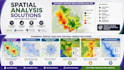
Do you need more than a map? I provide professional GIS spatial analysis to help you identify patterns, evaluate locations, and support better planning and decision-making.
Using ArcGIS Pro, QGIS, and industry-standard GIS workflows, I analyze spatial data to produce meaningful insights for researchers, planners, engineers, NGOs, government agencies, and environmental consultants.
Services include:
Ideal for:
Deliverables
I focus on producing accurate, reproducible analyses that help answer real-world questions and support evidence-based decision-making.
Message me before ordering so we can discuss your project goals, datasets, and analysis requirements.
Geomatics Engineer, Civil 3D, Survey Mapping, GIS
Level 2
Languages
What types of spatial analysis do you offer?
I provide a wide range of GIS analyses, including suitability analysis, buffer analysis, overlay analysis, proximity analysis, network analysis, hotspot analysis, density mapping, flood risk mapping, terrain analysis, accessibility analysis, and custom workflows tailored to your project.
What data do I need to provide?
If you already have GIS data such as shapefiles, GeoJSON, CSV files, CAD drawings, satellite imagery, or GPS coordinates, you can send them to me. If you don't have the required datasets, let me know—I can help source publicly available data or discuss alternative solutions.
Which industries do you work with?
I work with researchers, NGOs, government agencies, environmental consultants, engineers, urban planners, architects, utility companies, and businesses that require professional GIS analysis and mapping.
What software do you use?
I primarily use ArcGIS Pro and QGIS for GIS analysis. Depending on the project, I may also use Google Earth Engine, AutoCAD Civil 3D, Python, or other geospatial tools to achieve the best results.
Can you help if I'm not sure which analysis I need?
Absolutely. Many clients know the problem they want to solve but aren't sure which GIS analysis is most appropriate. Simply describe your project or research objectives, and I'll recommend the best approach before you place an order.
Should I contact you before placing an order?
Yes. Every GIS project is different. Sending me a brief description of your objectives and available data before ordering allows me to recommend the right package, confirm feasibility, and ensure you receive the most suitable solution.


