Browse categories
Explore
Fiverr Pro
English
$
USD

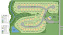
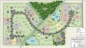
Property Maps, Real Estate Site Plans, Land Layouts & Plot Maps
I create property maps, real estate site plans, land layouts, plot maps, and illustrated property maps that help present land boundaries, building locations, access roads, and important site features in an organized and visually appealing way.
Whether you have a residential property, vacant land, housing development, commercial site, or real estate project, I can transform your sketches, existing plans, reference images, or supplied site information into a professional map suitable for presentations, property marketing, and digital or print use.
What I Offer:
Contact me before placing your order to discuss your project size, available references.
Please inform the freelancer of any preferences or concerns regarding the use of AI tools in the completion and/or delivery of your order.
Map Designer
Languages
What types of property maps do you create?
I create real estate maps, land layouts, plot maps, residential development plans, property location maps, and illustrated site plans.
What information do I need to provide?
You can provide a land sketch, existing site plan, plot dimensions, satellite image, property photos, or reference drawings.
Can you show individual plots, roads, and building locations?
Yes. I can include plot divisions, roads, access points, buildings, parking areas, landscaping, labels, and other features based on your supplied information.
Which file formats can you deliver?
I can provide high-resolution PNG, JPG, or PDF files. Editable source formats such as AI or SVG can be discussed before ordering.
Can you work from my existing land or site plan?
Yes. I can use your existing drawing or reference materials to create a clean and professionally presented map while following the information supplied.


