Browse categories
Explore
Fiverr Pro
English
$
USD


Hello, I am Ola.
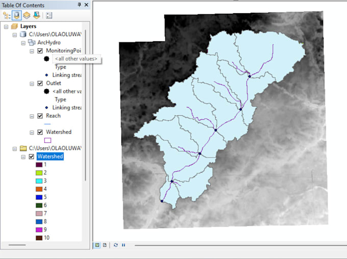
I'm a hydrological engineer, an agricultural researcher and a professional GIS analyst. I have 5 years of experience in using GIS and Remote Sensing. I know and use different software for GIS and hydrological modelling (ArcGIS, Google Earth, ArcSWAT, SWAT Check, SWAT CUP). I will do shapefile creation, watershed delineation, HRU Analysis and flood modelling. I will also create input files and necessary tables required for SWAT models like LULC map, Soil map, slope map, lookup tables, precipitation, temperature, humidity, wind speed and solar radiation. All model output files will be provided. Revisions will be up till your satisfaction.
We will have a good experience working together because I work efficiently and effectively.
Regards,
Ola.
Languages
Do you know how to prepare weather data input files?
Yes, I can prepare weather data input files. All I need from you is the data for the years you have gathered and whether there is a warm-up period or not. Having this information helps me effectively prepare the weather data for use.
Does watershed deineation have effect on climate change?
Yes, watershed delineation can help mitigate the drastic effect of the changing climate. I can enlighten you more on the topic if you want some knowledge on this matter.