Browse categories
Explore
Fiverr Pro
English
$
USD
You can still contact the seller.



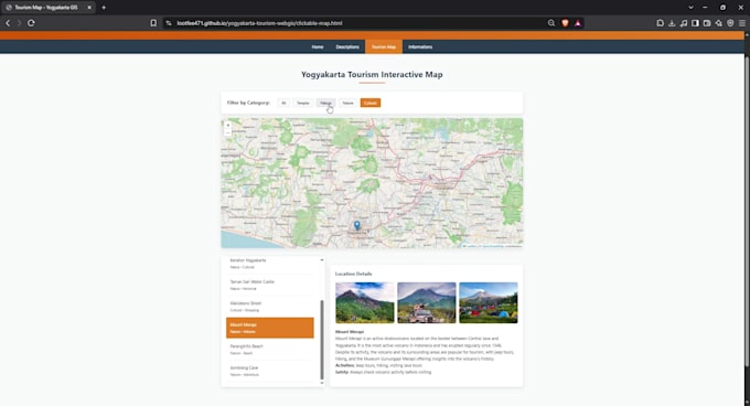
Turn your spatial data into a professional, interactive web map that works in any browser and on mobile. I have built production web-GIS applications with OpenLayers + GeoServer (WMS/WFS) and Leaflet dashboards with filtering, search, and popups.
WHAT I CAN BUILD:
- Interactive web maps (Leaflet / OpenLayers / MapLibre): popups, legends, layer toggles, search, marker clustering
- Filter & sidebar interfaces synced with the map (category filters, list/detail panels)
- Choropleth maps, heatmaps, point-density visualizations
- GeoServer setup: layer publishing, WMS/WFS services, SLD styling
- Loading your Shapefile/GeoJSON/PostGIS data into a live web map
- Responsive, mobile-friendly design, ready to embed in your website
EXAMPLES OF MY WORK:
- Tourism web map: 80+ attractions, 4 categories, image galleries, filter controls, fully responsive
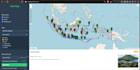
- Web-GIS app merging GeoServer WFS + GeoJSON layers with harmonized attribute schemas and 6-category filtering
CODE QUALITY: clean, commented code (HTML/CSS/vanilla JS or React on request), CDN integrity checks, error fallbacks. You receive the full source code and a deployment guide.
Spatial Data Science Enthusiast GIS Specialist
Languages
Can you host the map for me?
I deliver code you can host anywhere (GitHub Pages free, Netlify, your own server). Premium includes deployment assistance.
My data is in Shapefile/Excel/PostGIS, can you use it?
Yes, any format: SHP, GeoJSON, KML, CSV with coordinates, PostGIS. I'll also clean and convert inconsistent schemas as part of the job.
Can you add a backend (login, database editing)?
Yes, Premium covers a PHP/Python proxy with a spatial database (PostGIS). Tell me your stack.
Do you make the map match my website's design?
Yes, share your site URL or brand colors and I'll match fonts, colors, and layout.
Will it work on mobile?
All my maps are responsive by default and touch-friendly.