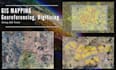
I will provide high-accuracy map digitization and precise georeferencing to convert your paper maps, PDFs, or satellite imagery into professional GIS vector data.
Full Description: Do you have scanned maps, historical blueprints, or satellite imagery that need to be converted into functional digital data? I specialize in transforming static images into intelligent, spatially accurate GIS layers.
What I Offer:
- Expert Digitization: Manual heads-up digitizing of points, lines, and polygons (roads, buildings, parcels, etc.) with strict topology rules to avoid errors.
- Precise Georeferencing: Aligning your scanned maps or aerial photos with real-world coordinates (WGS1984 or local systems) using ground control points.
- Format Conversion: Delivering data in your preferred format, including Shapefile (.shp), File Geodatabase (.gdb), KML/KMZ, or GeoJSON.
- Map Mosaicing: Skillfully joining multiple map sheets into a single, seamless digital dataset.
- Attribute Entry: Populating relational databases with relevant information for every digitized feature.
- Why Choose Me? With years of experience managing land and legal affairs data, I ensure that every vertex is placed with professional precision.