I will perform vegetation analysis and ndvi mapping using rs

M
mahwishmuzam593
M
mahwishmuzam593
Mahwish

About this gig

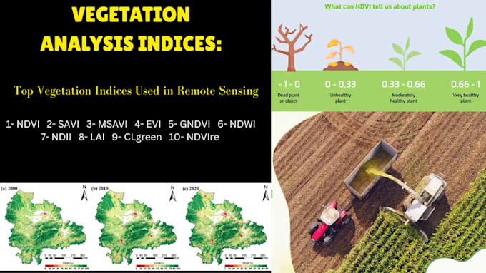
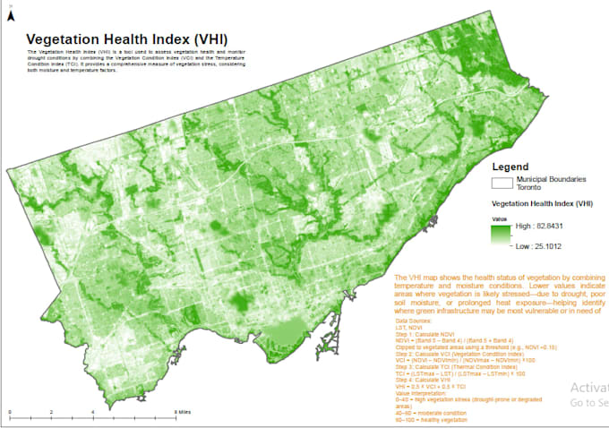
I specialize in remote sensing-based vegetation monitoring, land cover classification, and spatio-temporal change detection using ArcGIS and QGIS.

Whether it's for research, agriculture, forest monitoring, or climate studies, I will deliver high-quality vegetation maps, visuals, and analytical summaries.


What I Offer

  • NDVI, SAVI, and EVI Index Calculation
  • Time-Series Vegetation Change Detection
  • Land Cover Classification (Supervised/Unsupervised)
  • Crop Health & Biomass Analysis
  • Satellite Imagery Processing (Landsat, Sentinel, MODIS)
  • High-Resolution Map Layouts (PDF/JPEG)
  • Short Analytical Summary/Report


Why Choose Me

  • ️ Professional GIS & Remote Sensing Specialist
  • ️ 100% Custom Analysis Based on Your Area & Data
  • ️ Fast Delivery + Revisions Until Youre Satisfied
  • ️ Academic, Research, and Professional Project Support


For more samples of my GIS and remote sensing work,

Please visit my Fiverr profile portfolio.

Get to know Mahwish

Mahwish

Professional GIS and Remote Sensing Specialist

  • FromPakistan
  • Member sinceJul 2021
  • Languages

    English, Urdu
👋 Hi there! I'm Mahwish, a professional GIS specialist with over 12 years of experience in cartographic design, spatial analysis, geoprocessing, and map production. I work with ArcGIS Pro, QGIS, and Google Earth Engine to turn raw spatial data into clear, informative maps and analytical insights. My Expertise Includes: Thematic & topographic mapping Spatial and proximity analysis Raster processing & DEM-based analysis (slope, aspect, hydrology) Georeferencing, digitizing & data cleanup GIS-based reporting and visualization ✅ I’ve successfully completed academic, environmental, and pla

My Portfolio