Browse categories
Explore
Fiverr Pro
English
$
USD

Hi and Welcome!
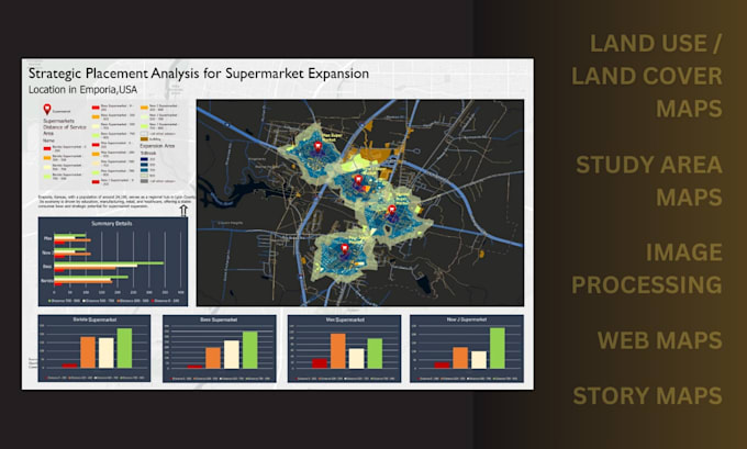
I am a GIS and Remote Sensing expert with over 7 years of experience providing high-quality geospatial solutions to researchers, students, businesses, and professionals. I specialize in transforming raw spatial data into clear, actionable insights using ArcGIS, ArcGIS Pro, QGIS, Google Earth Engine, Google Earth, and Google Maps. I handle all types of GIS projects, from basic mapping to advanced spatial analysis, remote sensing workflows, and web mapping.
My services:
Why Choose Me:
Contact me.
GIS Technician
Languages
What is GIS and how can it benefit my project?
GIS (Geographic Information Systems) is a technology used to collect, analyze, and visualize spatial data. It helps you understand patterns, relationships, and trends related to location, enabling better decision-making, accurate analysis, and professional map outputs for research, planning, busines
What GIS services do you offer?
I provide end-to-end GIS and Remote Sensing services, including spatial and raster analysis, geodatabase design, georeferencing, digitizing, land use/land cover analysis, site suitability analysis, image classification, 3D and network analysis, web mapping, cartographic map design, and GIS support f
Which software and tools do you use?
I work with industry-standard tools such as ArcGIS, ArcGIS Pro, QGIS, Google Earth Engine, Google Earth, Google Maps, Pix4D Mapper, ArcGIS Online, Leaflet, OpenLayers, and Illustrator for professional map layouts.
How do you ensure accuracy and quality in your work?
I use reliable data sources, proper coordinate systems, validated workflows, and best GIS practices. Every project goes through quality checks to ensure accuracy, clarity, and professional presentation.
Can you work with my existing data (shapefiles, KML, CAD, GPS data)?
Yes. I can work with shapefiles, KML/KMZ, AutoCAD files, GPS data, raster data, and various coordinate systems. I can also convert data between formats as needed.
Do you help with academic work like theses or research projects?
Yes. I regularly support students and researchers with GIS analysis, maps, figures, and methodological support for theses, dissertations, journal papers, and academic projects.
Do you offer web mapping and interactive maps?
Yes. I create interactive web maps using Leaflet, OpenLayers, and ArcGIS Online, suitable for websites, dashboards, and online visualization.
How long will my project take?
Your data is treated with full confidentiality. I do not share project data or results with third parties and follow secure data handling practices.
How much do your services cost?
Pricing depends on the project requirements, complexity, and timeline. Please message me with your project details for a customized and fair quote.
ow can I contact you before placing an order?
Simply click the “Contact Me” button and send a message with your project details. I’ll respond quickly and guide you through the next steps.