Browse categories
Explore
Fiverr Pro
English
$
USD

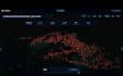
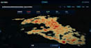
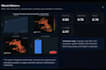
Build a Professional Interactive GIS Dashboard with ArcGIS, QGIS & Google Earth Engine
Are you looking for a modern, interactive GIS dashboard to visualize, analyze, and present your spatial data professionally?
You've come to the right place.
I specialize in developing custom GIS dashboards that transform complex geospatial data into clear, interactive, and decision-ready visualizations. Whether your project is related to environmental monitoring, urban planning, agriculture, utilities, transportation, research, or business intelligence, I can deliver a solution tailored to your needs.
Using ArcGIS Pro, ArcGIS Online, QGIS, Google Earth Engine, and Python, I build high-quality dashboards that are visually appealing, easy to use, and designed to support better decision-making.
Services I Offer
Interactive GIS Dashboards
ArcGIS Dashboards
GIS Mapping & Cartography
Spatial Data Analysis
Remote Sensing & Satellite Imagery Analysis
Google Earth Engine Applications
Web GIS Visualization
Buffer, Overlay & Network Analysis
Georeferencing & Digitizing
Spatial Data Conversion (Shapefile, GeoJSON, KML, CSV, GeoPackage)
Custom Maps & Data Visualization
Why Choose Me?
Professional GIS & Remote
GIS Analyst Remote Sensing ArcGIS Pro QGIS GEE
Languages
What do you need to start my project?
Please provide your spatial data (Shapefile, GeoJSON, CSV, Excel, KML, or GeoPackage), project requirements, preferred dashboard style, and any specific functionality you need.
Which GIS software do you use?
I work with ArcGIS Pro, ArcGIS Online, QGIS, Google Earth Engine, and Python to build professional GIS dashboards and perform advanced spatial analysis.
Can you create custom GIS dashboards?
Yes. Every dashboard is designed specifically for your project requirements, data, and visualization needs.
Do you work with satellite imagery?
Yes. I can process and analyze satellite imagery using Google Earth Engine and other GIS tools for environmental monitoring, land use analysis, vegetation indices, and more.
Should I contact you before placing an order?
Yes. Please contact me before placing an order so we can discuss your project requirements and choose the most suitable package.


