Browse categories
English
$
USD
Connect to your AI
Basic map preparation and satellite data processing
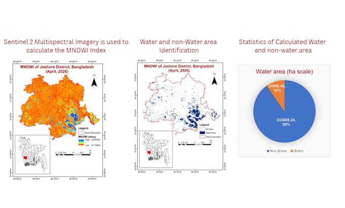
I will use Sentinel-2 satellite imagery and Google Earth Engine (GEE) to calculate NDWI/MNDWI for water body detection and mapping. I will classify water pixels, estimate water coverage area in hectares or square kilometres, and provide statistical summaries of the results. If required, I can also deliver water body boundary polygons in Shapefile format for further GIS analysis. Ideal for water resource monitoring, environmental studies, and land and water mapping.
Technology:
arcgis
Analysis type:
Quantitative analysis
•
Statistical analysis
Expertise:
Prediction
•
Forecasting
•
Statistics
•
Time series analysis
Programming language:
Java
