Browse categories
Explore
Fiverr Pro
English
$
USD
Topographic Engineer GIS and AutoCAD Expert Drone Image Processing Pix4Dmati
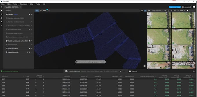
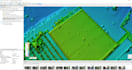
Professional Drone Image Processing using Pix4D and Agisoft Metashape
I am a topographic engineer specialized in drone data processing and photogrammetry.
I will process your drone images into high quality outputs such as:
I work using professional software:
High accuracy results
Fast delivery
Clean and professional outputs
I can handle small and large datasets from 0 to 6000 images.
Please contact me before ordering to discuss your project and ensure the best results.


What do you need to start the project
I need your drone images, coordinates if available, and any specific requirements for the output
What outputs will I receive
You will receive orthophoto, DSM, point cloud and other outputs depending on your package
Which software do you use
I use Pix4Dmatic and Agisoft Metashape for high quality and accurate results