Browse categories
Explore
Fiverr Pro
English
$
USD

Level 2
FOREST CARBON STOCK & BIOMASS MAPPING REDD+ MRV READY
Are you developing a carbon credit project, REDD+ baseline, or
EUDR-compliant supply chain? I deliver accurate, science-grade
forest carbon data using satellite remote sensing, following
IPCC 2019 guidelines.
DATA SOURCES
Sentinel-1/2, Landsat 8/9, Hansen GFC, UN WCMC Biomass,
NASA GEDI LiDAR.
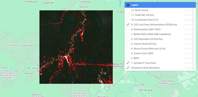
WHAT YOU GET
- Above Ground Biomass map (t/ha)
- Carbon Stock map (tC/ha)
- CO2 Equivalent map (tCO2e/ha)
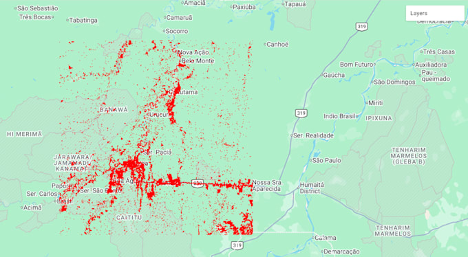
- Deforestation & change detection
- Professional PDF report with charts
- GIS files: GeoTIFF, Shapefile, KMZ
PERFECT FOR
Carbon credit developers, REDD+ MRV, agroforestry, EUDR
compliance, conservation NGOs, researchers, governments.
WHY CHOOSE ME
- Geologist with strong remote sensing expertise
- Verra & Gold Standard compatible methodology
- Fast and clear communication
- On-time delivery
Contact me before ordering with your project area and goals
for a custom offer.
Level 2
Languages