Browse categories
Explore
Fiverr Pro
English
$
USD


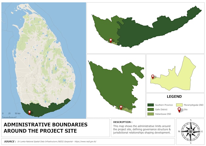
I provide professional GIS mapping, geospatial analysis, and remote sensing services using tools such as QGIS, Google Earth Engine, and Python. My services include high-quality cartographic map design, spatial analysis, land use mapping, terrain analysis, environmental assessments, urban planning analysis, and satellite image processing. I focus on delivering accurate, visually attractive, and data-driven outputs tailored to research, academic, infrastructure, and professional planning projects.
Professional GIS Specialist
Languages