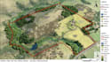
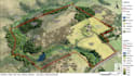
I will create interactive real estate map, property map, contour map, plat map, gis map

M
marcus_posey
M
marcus_posey
Marcus Posey

About this gig

Is your property data difficult to understand, boundaries unclear, or existing maps lacking accuracy and clarity? I create professional GIS and custom maps that transform complex spatial data into clear, informative visuals for planning, presentations, and decision-making.

Services include:

  • GIS Maps
  • Real Estate & Property Maps
  • Parcel & Cadastral Maps
  • Topographic & Terrain Maps
  • Elevation & Contour Maps
  • Land Use & Zoning Maps
  • Site & Location Maps
  • Interactive Maps
  • Boundary & Plat Maps

Why choose me?

  • GIS expertise using QGIS and ArcGIS Pro
  • Accurate mapping and spatial analysis
  • Clear layouts with professional labeling
  • Custom legends, scale bars, and north arrows
  • High-quality, print-ready and digital outputs

You'll receive:

  • High-resolution PDF, PNG, or JPG
  • Editable GIS project files (if requested)
  • Organized layers and integrated source data
  • Revisions to ensure your satisfaction

Send me your parcel data, coordinates, shapefiles, sketches, or project requirements, and I'll create a precise, professional map tailored to your needs. Contact me before ordering to discuss your project!


Delivery style preference

Please inform the freelancer of any preferences or concerns regarding the use of AI tools in the completion and/or delivery of your order.

Get to know Marcus Posey

Marcus Posey

Map Design

  • FromUnited Kingdom
  • Member sinceSep 2026
  • Avg. response time2 hours
  • Languages

    English
I’m a GIS and mapping specialist who turns complex geographic information into clear, accurate, and visually compelling maps. I combine technical spatial knowledge with thoughtful cartography to create work that is both practical and easy to understand. My experience includes digital mapping, spatial analysis, data visualization, terrain representation, location intelligence, and custom cartographic work. I work with QGIS, ArcGIS Pro, and other professional tools to handle diverse mapping requirements with precision and care. Whether you have raw data, reference files, or a simple idea.