Browse categories
Explore
Fiverr Pro
English
$
USD

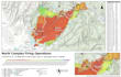


I got into cartography and spatial analysis making publication figures for my fiancées dissertation and academic journals. I have been a GIS developer for 10 years, so I knew what journal reviewers expected from spatial figures and could produce maps that cleared peer review on the first submission. Other grad students and researchers started reaching out, and the work grew into the full range of spatial visualization projects.
Now I make maps for environmental reports, energy and mining presentations, planning applications, forestry operations, and site evaluations. If your project involves spatial analysis like suitability scoring or proximity modeling, I document the methodology so your results are reproducible.
Data cleaning, reprojection, and format conversion are built into every project. Deliverables come with proper symbology, coordinate systems, and metadata. I deliver polished PDF map sheets, geodatabase feature classes, georeferenced imagery, or packaged map projects your team can open and edit.
I love figuring out how to represent a concept spatially and perform new analysis. Message me your project details and I will scope it out.
FullStack GIS Developer: Custom Web Apps and Spatial Databases
Languages


