Looks Like This Service Is On Hold

I will produce professional maps and do geospatial analysis

M
mcneill_intel
M
mcneill_intel
Scott McNeill

About this gig

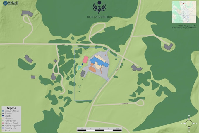
I create professional maps and geospatial products for real estate, land use, construction, and business applications. Deliverables include high-quality map exports and optional spatial data files.

Get to know Scott McNeill

Scott McNeill

Geospatial Analyst, Software Engineer

  • FromUnited States
  • Member sinceJan 2026
  • Avg. response time4 days
  • Languages

    English
McNeill Spatial Intelligence (MSI) provides professional drone imaging and geospatial data services based in Houston, Texas. We specialize in commercial aerial photography, construction progress documentation, inspections, and GIS-ready mapping deliverables. FAA Part 107 licensed, MSI delivers high-resolution 4K imagery and structured spatial data designed for real-world use. Clear communication, reliable execution, and measurable results.

My Portfolio