I will drone image process with 3d model,dsm dtm ,orthomosaic by agisoft,pix4d

M
md_mulex
M
md_mulex
Md.alex

About this gig

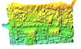
Providing services of all images processing:

·      Drone Image processing with GCP

·      Drone Image processing without GCP

·      UAV Drone Mapping

·      Build dense point cloud

·      Lidar /Las point cloud processing

·      Tie points

·      Dense point classification

·      3D model(OBJ,STL formats or orthers)

·      Build(DEM,DTM,DSM,TIN and orthomosaic)

·      Contours

I am proficient in these software:

·      Agisoft metashape profession

·      Pix4D

·      Arc scene

·      Photoscan

·      ArcGIS

·      QGIS

·      Autocad

·      Civil 3d

Get to know Md.alex

Md.alex

GIS and WebGIS Expert

4.9(9)
  • FromBangladesh
  • Member sinceAug 2020
  • Avg. response time1 hour
  • Last delivery9 months
  • Languages

    Bengali, English
I am Alekzandar, you can call Alex. I am a GIS and web GIS expert. I have completed a Bachelor's and Master's degree in geography and environment science. I have 8 years of experience at digital mapping center in Bangladesh. Not only computer base experience but also have field work experience in survey. I am proficient in GIS mapping and web GIS mapping. I've mostly work with Arc GIS, QGIS, postGIS, JavaScript, leaflet, Mapbox, Angular8, Open layer, python(folium, Pandas), PostgreSQL, MySQL, and Geoserver.I am always trying to work with punctuality, Sincerely and Honesty.

My Portfolio