Are you looking for professional GIS and Remote Sensing solutions to turn complex spatial data into actionable insights?
With a background in geography, I provide complete geospatial solution for your research, project or academic work.
What I Offer:
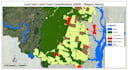
- Remote Sensing: LULC classification, Change Detection, and Satellite Imagery processing (Landsat, Sentinel).
- Advanced Analysis: Multi-Criteria Decision Analysis (MCDA), Suitability Mapping, and Network Analysis.
- Environmental Modeling: Urban Heat Island (UHI) analysis and Hydrological modeling (Runoff/Curve Number).
- Data Visualization: Professional cartography, 3D maps, and digitization (KML, Shapefile, GeoJSON).
- Machine Learning: Integrating Random Forest or KNN for predictive spatial modeling.
Why Choose Me?
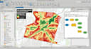
- Technical Expertise: Expert in ArcGIS Pro, QGIS, Google Earth Engine, and Python.
- Industry Experience: Professional experience in urban governance programs.
- Analytical Depth: I provide technical insights, not just maps.
Please contact me before placing the order and discuss together.