Browse categories
Explore
Fiverr Pro
English
$
USD



Need more than just a map?
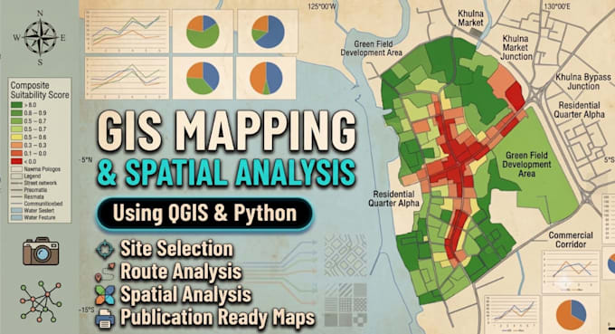
I provide professional GIS mapping and spatial analysis services using QGIS and Python to transform spatial data into clear, accurate, and decision-ready results. Whether you're a researcher, student, planner, consultant, or business owner, I can help create high-quality maps and meaningful geographic insights.
Services include:
GIS Mapping & Cartography
Spatial Analysis
Buffer, Overlay & Proximity Analysis
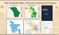
Site Suitability Analysis
Network & Route Analysis
Spatial Data Processing & Cleaning
Shapefile, GeoJSON & KML Processing
Publication-Ready Maps
Why choose me?
Urban & Regional Planning background
ESRI Spatial Analysis certified
Modern GIS workflow using QGIS & Python
Clean, accurate, and well-organized deliverables
Clear communication and reliable delivery
Please contact me before placing an order so we can discuss your project requirements and choose the best solution for your needs.
I turn geographic data into clear, actionable insights
Languages
What information do you need to get started?
To get started, please provide your project requirements, the purpose of the map or analysis, your study area (AOI), and any available GIS data such as Shapefile, GeoJSON, KML, CSV, Excel, or coordinates. If you don't have data, feel free to contact me before ordering.
What file formats do you accept?
I can work with Shapefile (.shp), GeoJSON, KML/KMZ, CSV, Excel, GeoPackage, raster files, and many other common GIS formats.
What will I receive after the project is completed?
Depending on your package, you will receive high-quality maps (PNG, PDF, JPEG), GIS data files when applicable, and spatial analysis results. Editable project files can also be provided if requested.
Can you create custom GIS maps based on my requirements?
Yes. Every project is customized according to your requirements. Whether you need thematic maps, research maps, business location maps, or spatial analysis, I will tailor the work to your project goals.
Do you provide spatial analysis as well as GIS mapping?
Yes. Besides GIS mapping, I also provide spatial analysis services such as buffer analysis, overlay analysis, proximity analysis, site suitability analysis, and other GIS-based analytical workflows depending on your project requirements.
Can you work with incomplete or messy data?
Yes. If your data is incomplete, unorganized, or contains formatting issues, I can often clean, organize, and prepare it before starting the GIS analysis. Please contact me first so I can review your data.
Should I contact you before placing an order?
Yes, I highly recommend contacting me before placing an order. This allows us to discuss your project requirements, review your data, and select the most suitable package to ensure the best possible outcome.