Browse categories
Explore
Fiverr Pro
English
$
USD


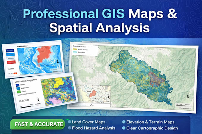
If you need accurate and professional GIS maps or spatial analysis, you are in the right place.
I help researchers, students, planners, and organizations turn spatial data into clear and useful maps. Using professional GIS tools, I deliver maps that are clean, well-structured, and ready for reports, research, or presentations.
Services I Provide
Tools I Use
What You Will Receive
Why Choose This Gig
If you are unsure about your project, feel free to send a message before ordering. I will review your requirements and guide you.
GIS and Remote Sensing Consultant Satellite Data Analysis and Mapping
Languages
What data do I need to provide?
You can provide shapefiles, coordinates, or any spatial dataset. If you are unsure, I can guide you.
What format will the final maps be delivered in?
Maps can be delivered in PDF, PNG, JPG, TIFF, or other formats depending on your needs.
Can you work on academic or research projects?
Yes. Many GIS projects are related to research, environmental studies, or planning.
Can you customize the map style?
Yes. Colors, labels, scales, and layouts can be customized to your requirements.