Browse categories
Explore
Fiverr Pro
English
$
USD

Level 1

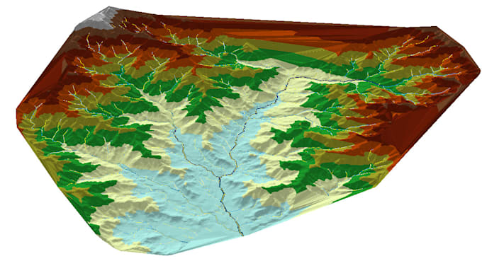
I am a Hydraulic Engineer with over 7 years of professional experience as a Hydraulic Modeler, specializing in GISbased mapping and spatial analysis for water resources and infrastructure projects. I have successfully delivered multiple projects using ArcGIS, producing accurate, wellstructured, and presentationready maps for engineering studies and reports.
My expertise includes creating maps from satellite imagery and Google Earth, processing spatial data, and ensuring correct projections, georeferencing, and cartographic standards. I focus on accuracy, clarity, and practical outputs that support hydraulic and hydrological analysis.
Services I Offer:
All deliverables are prepared with professional labeling, symbology, and coordinate systems, suitable for engineering, environmental, and planning applications.
Clear communication
Engineering accuracy
Ontime delivery
Please contact me before placing an order.
Civil Engineer, Hydrologist and Hydraulic Engineer ,Expert in HEC RAS, HEC HMS
Level 1
Languages
| (2) | ||
| (0) | ||
| (0) | ||
| (0) | ||
| (0) |
cfence

United States
We had multiple Zoom calls in order to get it right the first time and he beat the agreed to schedule!
$200-$400
Price

Seller's Response
martinbleasel

Australia
Very easy to communicate with, and asked lots of appropriate questions to get the job done correctly.
$200-$400
Price
Seller's Response
| (2) | ||
| (0) | ||
| (0) | ||
| (0) | ||
| (0) |
cfence
United States
We had multiple Zoom calls in order to get it right the first time and he beat the agreed to schedule!
$200-$400
Price
Seller's Response
martinbleasel
Australia
Very easy to communicate with, and asked lots of appropriate questions to get the job done correctly.
$200-$400
Price
Seller's Response