Browse categories
Explore
Fiverr Pro
English
$
USD
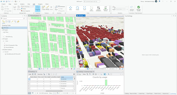
2D to 3D GIS conversion refers to the process of transforming a traditional two-dimensional Geographic Information System (GIS) into a three-dimensional system that incorporates topographical data and can display information in a more immersive and interactive way. This process involves the use of digital elevation models, 3D modeling software, and visualization tools to create a more realistic representation of geographical features and data