Browse categories
Explore
Fiverr Pro
English
$
USD


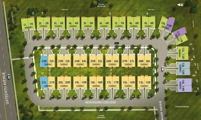
Planning a successful land development project starts with a well designed subdivision plan. I provide professional subdivision planning services for residential, commercial, and mixed use developments, ensuring every layout is clear, organized, and ready for presentation or further engineering work.
Whether you need a simple parcel split or a complete subdivision master plan, I will create accurate layouts that maximize land use while considering road networks, lot configurations, access points, green spaces, and utility corridors.
What I Can Design
Services Included
I focus on delivering accurate, clean, and professional drawings that meet your project requirements while maintaining excellent communication throughout the project.
Please message me before placing your order so we can discuss your project requirements and choose the best package.
Please inform the freelancer of any preferences or concerns regarding the use of AI tools in the completion and/or delivery of your order.
Hiking map
Languages
Can you create subdivision plans from a survey drawing?
Yes. I can create an accurate subdivision plan using your survey plan, land dimensions, or boundary coordinates.
Can you add roads, green areas, and utility corridors?
Yes. I can include road networks, open spaces, utility corridors, and other planning elements where required.