Browse categories
Explore
Fiverr Pro
English
$
USD
Need high-quality LiDAR classification and terrain modeling for engineering or environmental projects?
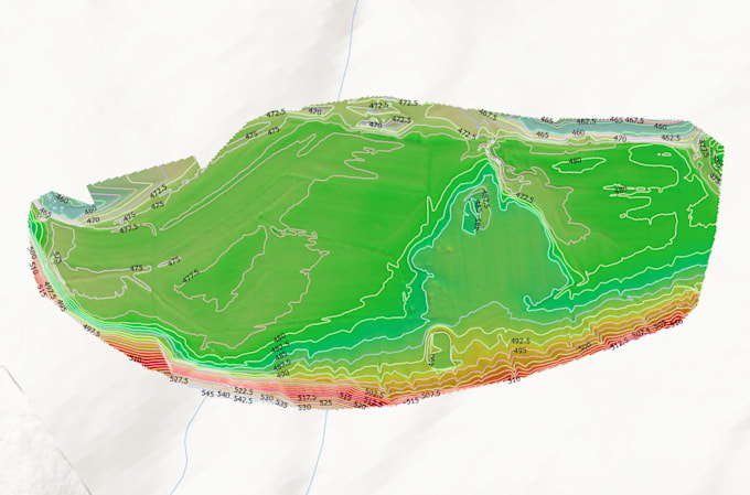
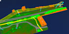
I provide professional LiDAR point cloud processing, turning raw .LAS/.LAZ data into accurate classified datasets and surface models (DEM, DSM) ready for GIS, CAD, or BIM workflows.
With over 5 years of experience in UAV & LiDAR data, I deliver clean, reliable results for topographic mapping, flood analysis, forestry, and site design.
What youll get:
Software: TerraScan, LAStools, ArcGIS Pro, CloudCompare, Global Mapper
What input formats do you accept?
I can process .LAS, .LAZ, .E57 LiDAR data.
Which classification scheme do you use?
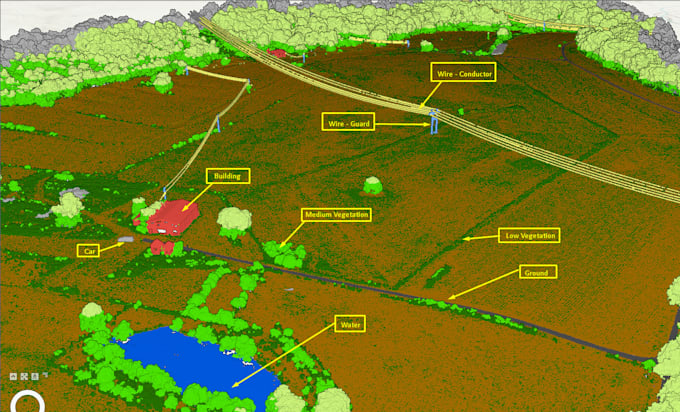
I follow ASPRS LiDAR standards, identifying classes such as ground (2), vegetation (3–5), buildings (6), noise (7, 18), and others if required.
Can you handle large projects (e.g., 50+ ha)?
Yes. I process in tiles or batches and can prepare a custom quote for large datasets.
| (1) | ||
| (0) | ||
| (0) | ||
| (0) | ||
| (0) |
ajsurveying

Saint Lucia
Chung did an outstanding job, and I look forward to doing business with him again.
$600-$800
Price
3 days
Duration

Seller's Response
| (1) | ||
| (0) | ||
| (0) | ||
| (0) | ||
| (0) |
ajsurveying
Saint Lucia
Chung did an outstanding job, and I look forward to doing business with him again.
$600-$800
Price
3 days
Duration
Seller's Response