Browse categories
Explore
Fiverr Pro
English
$
USD


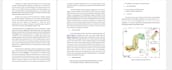

I offer professional GIS mapping, remote sensing analysis, and spatial data processing services for research, projects, and business applications. Using advanced tools like ArcGIS, QGIS, and Google Earth Engine, I can generate accurate maps, perform land use/land cover classification, conduct terrain and environmental analysis, and create high-quality visualizations.
My services include:
I ensure high-quality, reliable, and timely delivery for all types of spatial projects. Whether you are a researcher, NGO, government agency, or business, I provide actionable insights through geospatial data analysis to support informed decision-making.
Turning Spatial Data into Smart Insights:GIS and Remote Sensing Expert
Languages
What software do you use for GIS and remote sensing?
I use ArcGIS, QGIS, and Google Earth Engine to perform mapping, analysis, and visualization.
Can you process my own GIS or satellite data?
Yes! You can provide your datasets, and I will analyze, map, and visualize them as required.
What types of maps and analysis can you create?
I can create thematic maps, LULC maps, terrain analysis, environmental modeling, and spatial analysis for research, business, or projects.
Do you offer fast delivery for urgent projects?
Yes, I offer priority delivery options depending on the package and project size.


