Browse categories
Explore
Fiverr Pro
English
$
USD

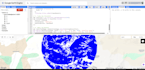


I provide high-quality Land Use Land Cover (LULC) classification using Google Earth Engine GEE. My service includes data selection, image preprocessing, cloud masking, band combination, training sample creation, and supervised classification using advanced machine learning algorithms such as Random Forest or SVM. I generate accurate LULC maps for any region and time period, including change detection analysis between multiple years. You will receive classified maps, accuracy assessment, legend, and exportable GIS files. This service is ideal for environmental studies, urban planning, agriculture monitoring, research, and geospatial projects requiring reliable land cover information.
Turning Spatial Data into Smart Insights:GIS and Remote Sensing Expert
Languages


